Arid Land Research Fund

Improving the effectiveness of rehabilitation techniques at multiple scales!

Project #1

Calibrating satellite imagery with on-the-ground plant & soil factors.

Research Objective

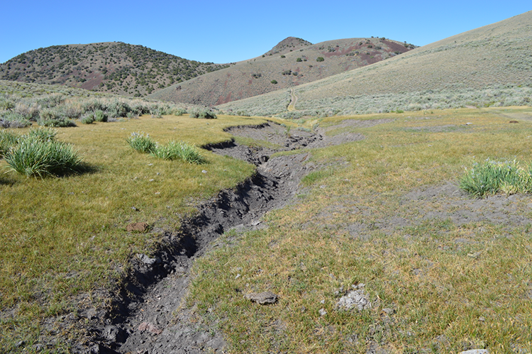
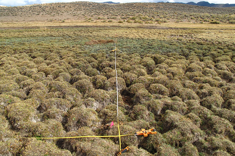
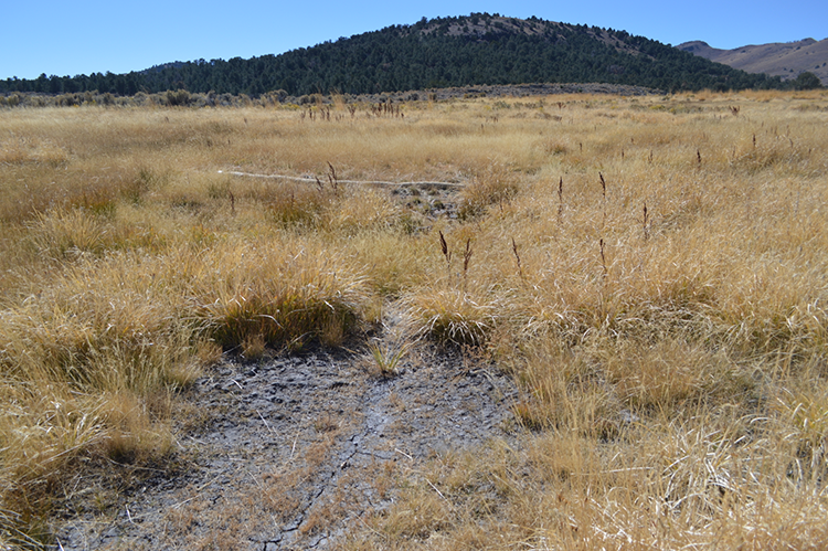
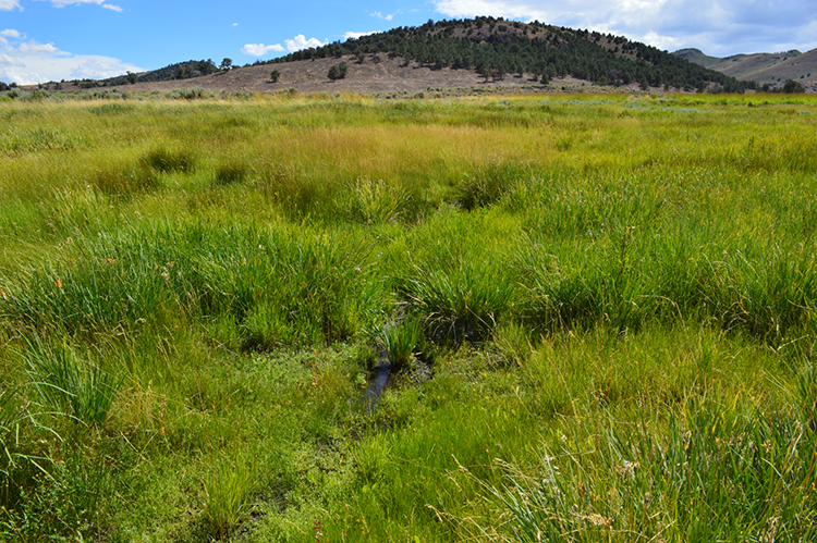
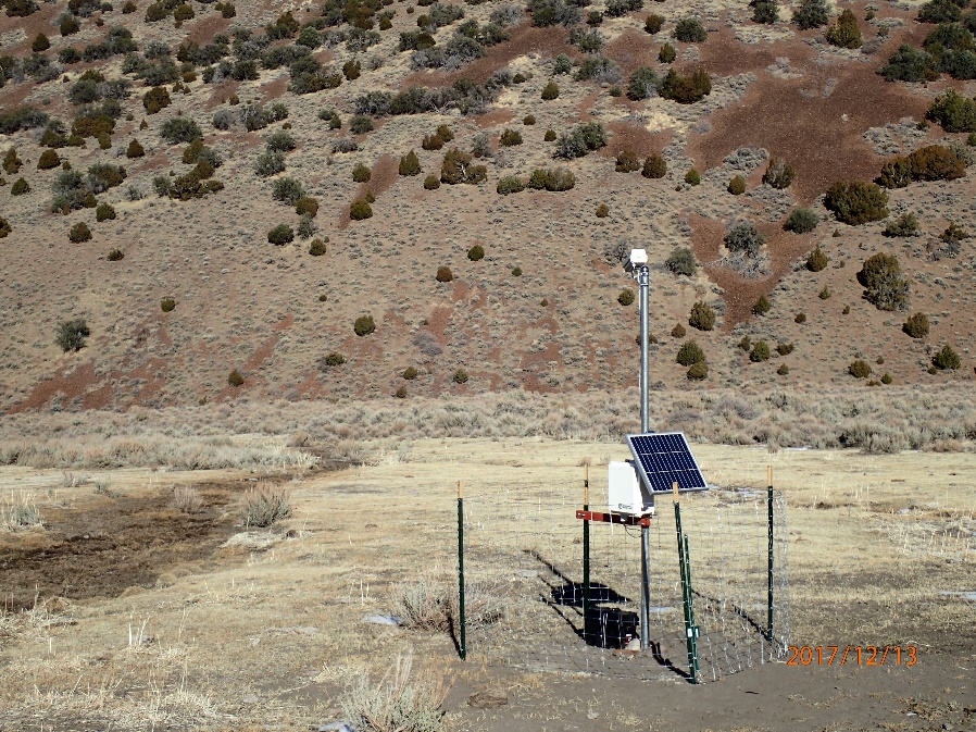
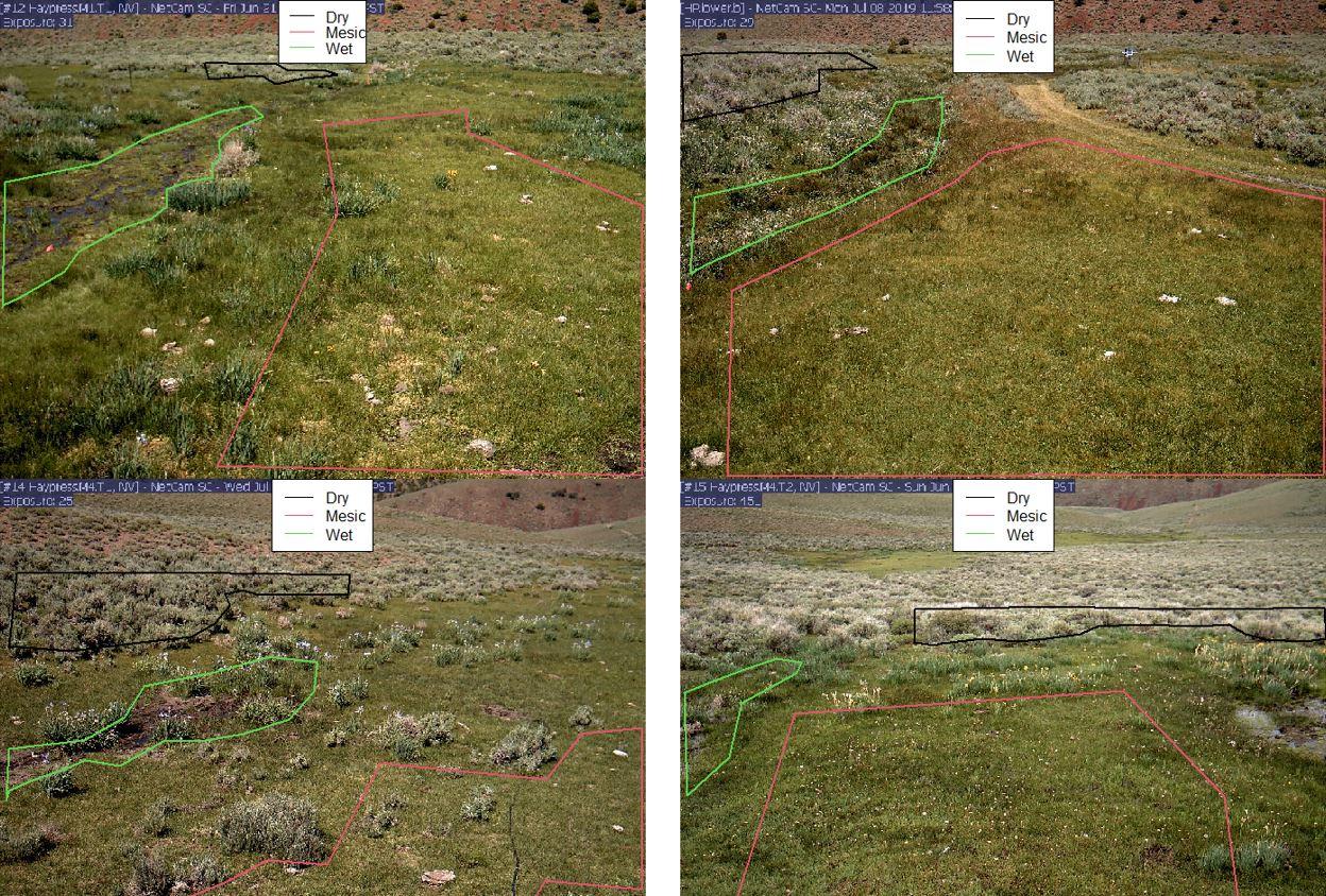
  • Create 3 conditions within a fenced 1-acre area adjacent to a natural spring
  • Measure soil colour, redox, carbon, CO2 fluxes, plant condition, soil cover
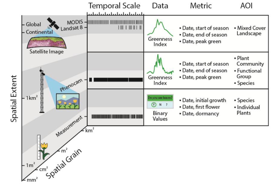
  • Calibrate measured factors with satellite imagery

Relevance

  • The ability to remotely measure plant and soil conditions over large and often hard-to-access areas using satellite imagery will be an important tool in the fight against desertification globally.

Riparian Areas

Importance in arid and semi-arid ecosystems disproportionate to actual size.

  • Boost landscape diversity
  • Filter Water
  • Provide forage and water for livestock
  • Serve as suitable habitat for key wildlife taxa
  • Contain 3 times the amount of carbon (C) as surrounding uplands

Inappropriate Grazing

Livestock, horses, and burros congregate in riparian areas due to increased water and forage.

Improper grazing management:

  • Destabilizes soil
  • Reduces vegetation
  • Increases erosion
  • Limits nutrient stocks
  • Decreases C storage

Objectives

Wetlands affected by degradation.

Determine the area occupied by wetlands, within the research site, prior to settlement and estimate C losses associated with the reduction in size following degradation.

Degraded area.

Assess the restoration potential of degraded areas through three treatments: no-grazing, controlled grazing and uncontrolled grazing.

Controlled Grazing and Tree Removal

A field in 2016 before controlled grazing and tree removal.

2016

A field in 2017 after controlled grazing and tree removal.

2017

Monitoring Change

A graph by Browning, Snyder, and Herrick monitoring change in the Great Basin.
  • Monitoring phenology in the Great Basin is a unique challenge.
  • Understanding relationships between on-the-ground measurements and satellite imagery could allow for extrapolation across landscapes.
  • Repeat high-resolution photography (phenocams) has the potential to bridge the gap between satellite imagery and in-situ measurements.

Phenology Camera

A phenology camera capturing a phenological signature.
  • Utilize PhenoCam technology to determine the phenological signature of the meadow plant communities under the three grazing management treatments.
  • Correlate PhenoCam data with Landsat imagery. Utilize correlation to model the phenological signature of non-instrumented Great Basin meadows.

Phenocam Methodology

Computation results for four separate images, by Phenopix.
Phenopix, R statistical package

Budget & Schedule

Years 1-5

  1. $100,000
  2. $60,000
  3. $60,000
  4. $60,000
  5. $60,000

Total: $340,000

To make a donation to the fund

Please contact Christina Sarman


Who do I contact for more information?

Tamzen K. Stringham, Endowed Professor of Rangeland Science
Tamzen