On February 25th, Rich Koehler, an associate professor in the Nevada Bureau of Mines and Geology, flew from Reno to Turkey. Nineteen days earlier, a massive 7.8 magnitude earthquake rocked Turkey and Syria, followed by a 7.7 magnitude earthquake just nine hours later.
Koehler is part of the Geotechnical Extreme Events Reconnaissance (GEER) Association, which collects perishable data after natural disasters before the data is erased during recovery efforts. The data, which shows how structures failed or how the land was displaced, is open access and can help researchers understand how and why infrastructure was unable to withstand the disaster, providing engineers with valuable information on making the infrastructure more resilient.
Prior to his departure, one of Koehler’s colleagues in GEER was sent to Turkey to assess whether a data reconnaissance team would be valuable.
“And of course, it’s a lot to learn and a lot to see and so big, that yeah, we wanted to deploy to get over there,” Koehler said.
Koehler had previously been to Turkey for six weeks, studying faults that crossed a crude oil pipeline that was being built, which he credits for his being chosen to go to Turkey on the GEER team.
“I was just lucky enough to go and bring that experience back to share with my colleagues here,” Koehler said.
While Koehler was in Turkey in February, he experienced a smaller aftershock. They can occur long after major earthquakes, sometimes years later.
In the aftermath of natural disasters, one of the main priorities for the residents affected is to rebuild their homes. As the rebuilding happens, rubble is cleared and discarded, which makes it harder for the researchers to understand how the infrastructure and land was affected by the quake.
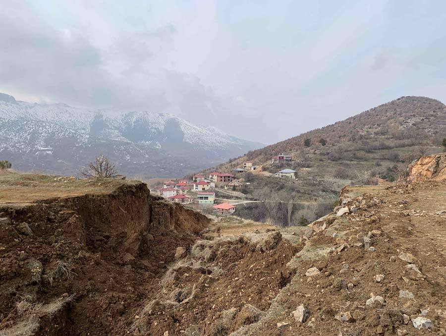
“We witnessed the destruction of the fault scarp in a lot of places,” Koehler said. “Repair people, repairing roads and stuff like that. Farmers want their fields to be flat again. So, they’re actively bulldozing the features that we want to measure.”
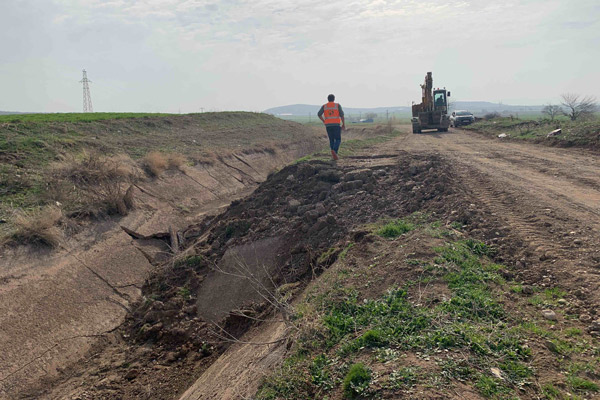
The people working to rebuild their lives were key in helping the GEER team collect data. In one instance, Koehler and his colleagues came across a concrete drainage ditch. It served as an ideal data point because there is a clear “piercing line” that allows the researchers to see what the movement was like in that location. A backhoe arrived at the drainage ditch to clear the rubble. Koehler and his colleagues asked the man operating the backhoe for a few more minutes with the drainage ditch before the data was destroyed.
“He was like, ‘Yeah, okay, no problem,’” Koehler said. “We’re science, which we know is important, and we have all the reasons why we know it’s important to get this data. But we’re minor compared to getting these folks back on their feet.”
Research methods
Koehler was part of a team of three geologists and five geotechnical engineers GEER deployed. The long days are spent collecting as much data as possible.
“You get up every morning, you just go all day until it gets dark and then come back to the hotel, get some food, and then download photographs and notes, GPS points, and just make sure everything is downloaded as a backup of data,” Koehler said.
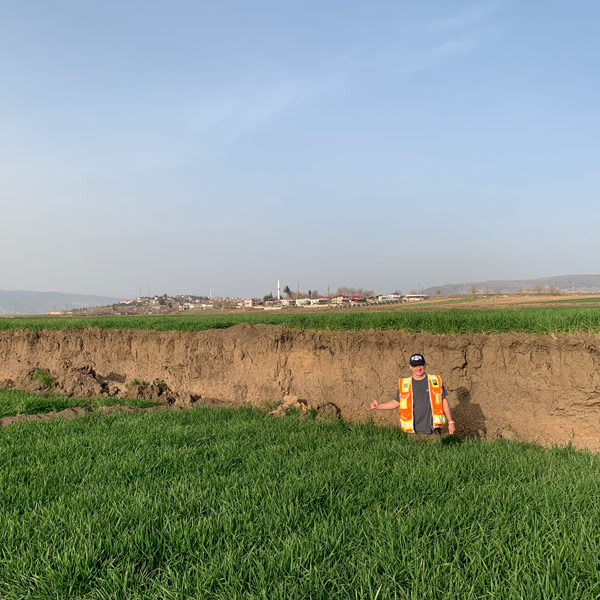
Koehler was primarily interested in determining the width of the deformation on the ground’s surface, how wide the zone of cracking is, and the amount of deformation along individual cracks. Koehler’s role is like a forensics expert, looking at old earthquake faults and trying to parse out the impact it had on a more recent earthquake.
“In my job here at the University, we study old ruptures, when they ruptured, and how big they were and where they went across the landscape,” Koehler said.
This type of work allows researchers to better assess recurrence intervals, which is the time between big surface-rupturing earthquakes and can help the scientists better identify probabilities for future seismic events. In addition, the scientists can ask questions based on their findings. If they forecasted that a fault would move a different way, they can try to understand how and why the fault moved like it did.
Koehler’s team worked closely with researchers at the U.S. Geological Survey (USGS) in Boulder, Colorado. The USGS team shared photos and satellite maps with the researchers on the ground in Turkey, allowing them to identify locations of interest more quickly and compare the data collected using satellites with what the researchers found on the ground. The researchers in Turkey were able to validate or correct what the USGS had seen from space and fill in the gaps where the satellites weren’t able to provide data, like the faults in forests where the canopy blocked the satellite view.
“That just shows how the field and the remotely sensed work kind of complement each other in really good ways,” Koehler said.
Findings
In the final GEER report about the February earthquakes released in July, the researchers state that the earthquake had classic strike-slip geomorphology, “which means that one side of the fault moves horizontally with respect to the other side,” Koehler said. “But as with any of these types of ruptures, there’s local vertical deformation and it’ll face either direction.”
The largest horizontal deformations the researchers found was 8.6 meters, or a little over 28 feet. Koehler points out that this deformation of up to 28 feet happened within tens of seconds.
The researchers found that most of the ruptures occurred along faults that were known prior to the earthquake, but some were not, which leads to more questions the researchers can pursue.
“My heart goes out to all the people who are affected, and hopefully this kind of work will help us understand hazards and risk better to apply to other countries that have similar problems with their infrastructure and seismic hazard,” Koehler said.
Difficulty of being in a disaster zone
As people began to remove rubble and rebuild, the GEER team did its best to stay out of the way of response and recovery efforts.
“It is really hard, it’s emotionally hard,” Koehler said. “We try to stay out of everybody’s way, basically, and try to help people when they want help.”
Koehler said that it can be difficult to travel to the site of such a traumatic event and focus on work.
“When you’re doing this, you sort of have to internalize it a little bit and just stick to the task at hand, and it’s hard, but you don’t think about it too much,” Koehler said. “But you think about it when you get home and you start to see your family and stuff, and you know, it hits you really hard.”
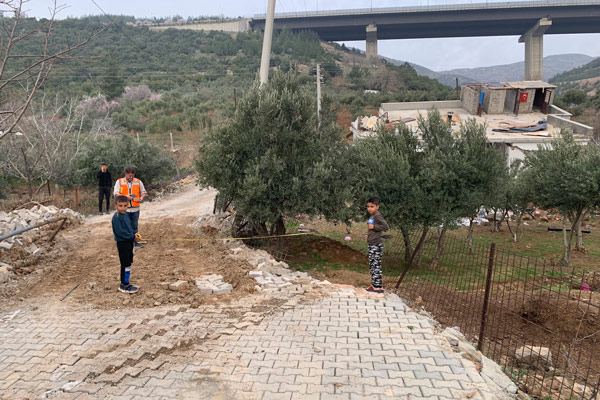
There were some uplifting moments when he and his colleagues were able to talk to the locals and hear their stories about being in the quake, and the researchers could share their knowledge about the quake with people who were directly affected.
“They want to know about earthquakes, they’re curious,” Koehler said. “They see you with your orange vest and your hard hat and they know you’re some kind of official person, you know, with expertise. We had Turkish colleagues with us that could help us communicate. And it was really nice talking with some of the children in the countryside who were fine. They had funny stories of falling down in the fields, and they were herding their goats around where we were making measurements. So that little personable feeling and talking with people translating on phones and talking about their experience, you know, that was really nice.”


