Ben Mason, associate professor in the Department of Geological Sciences and Engineering, is part of the recently funded Center for Land Surface Hazards (CLaSH), which integrates several disciplines to better understand land surface hazards such as tsunamis, earthquakes, landslides and more. The Center received $15 million in funding from the National Science Foundation (NSF).
Land surface hazards are often linked. For example, wildfires can result in increased erosion following a rainstorm, which may lead to a landslide. That landslide may disrupt the flow of a river, causing flooding. Mason and his colleague at the University, Scott McCoy, coauthored a paper calling for increased attention on this domino effect, published in the journal Science last year.
“[The paper was] very well-received by the community,” Mason said. “This idea of the cascading hazard has really become a lot more mainstream, scientifically.”
Several years ago, the NSF solicited proposals for a two-track grant model. Mason was part of the group of scientists who submitted a proposal to create CLaSH to better understand land surface hazards. Track I is designed to help scientists build the base for a future major research center, and provides two years of funding. Given success in that track, Track II provides funding for the center. CLaSH secured Track II funding from the NSF to support the Center over the next 5 years.
CLaSH aims to establish a scientific framework for understanding land surface hazards and projecting how risk might change in the coming years, train a workforce that understands these hazards and how they are interrelated, and increase participation from non-geoscientists in addressing these hazards. These aims will be achieved through partnership with scientists in areas such as atmospheric science, geomorphology and geotechnical engineering and by conducting post-event reconnaissance, offering small grants to bring new scientists into the community and hosting a graduate student field camp.
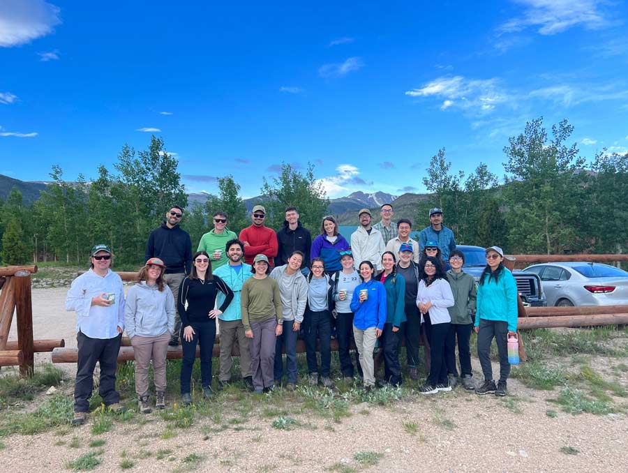
The field camp is highly competitive, with a 12% acceptance rate, and attracts students from all over the world.
“We really got, just, world-class students,” Mason said. “They were sponges.”
The camp is held at the Colorado State University Mountain Campus, in collaboration with EarthScope, which provides access to instrumentation and training from technical staff. The field camp returning to the same location provides opportunities for students to learn about change detection methods. For Mason, the field camp is the perfect blend of his passions.
“My favorite part about this job is interacting with students,” Mason said. “The privilege of my job is advising [and] interacting with students.”
Cascading hazard science was a fringe idea just a few years ago, Mason said, but it seems to have caught on, particularly after Mason and McCoy’s article came out last year. Mason said that at conferences, sessions are planned entirely around the linkages between land surface hazards. Yet planning effectively for those hazards remains a challenge, especially in under-resourced or small communities and in communities where the timescale for a hazard such as an earthquake is hundreds of years.
“I think part of our job as scientists is to communicate about these hazards very, very honestly, not to overstate them … but not to understate them either,” Mason said.
CLaSH partners with government groups, local community organizations and the public to discuss those risks. In places like Alaska, which faces permafrost thaw, glacial lake outbursts, earthquakes, volcanoes, tsunamis, wildfires and landslides, communication is key. The Alaska contingent of CLaSH has been working with Indigenous communities in the region, collecting oral and written histories to understand the disasters that have happened in the past. This is just one way scientists can gain a better understanding of the risk landscape and work with communities to identify solutions or strategies when faced with these risks.
Another method is by conducting post-event reconnaissance, which is Mason’s area of expertise. Following a hazardous land surface event, the CLaSH group will dispatch a group of scientists to collect perishable data, such as the height floodwaters reached or the thickness of a mudslide layer. The scientists are mindful of ongoing rescue and recovery efforts and hope to provide information to the communities they study that can help the communities be safer and more resilient in the future.
The reconnaissance work includes taking aerial imagery using drones and LIDAR as well as other measures. The data are stored in a database and made accessible to geoscientists working on land hazard issues. It can be very challenging getting to the site of a land surface hazard event. Mason said that one of the benefits of being part of the Center is access to staff who can help researchers get permits to visit the sites, as many of the researchers are academics who have to arrange for the classes they’re teaching while they’re away, plan travel and more. The Center is also partnering with agencies like the U.S. Geological Survey, which lends the researchers credence and may help them get permits faster during a time when every minute matters for collecting perishable data.
Mason looks forward to seeing how land surface hazard science will continue to advance with CLaSH. The Center is led by four co-Principal Investigators and one lead investigator, Marin Clark, at the University of Michigan.
“The PI is exceptional, she’s a top-notch researcher and has been a great leader for the project,” Mason said.


