The layer of Earth where life exists, from the top of the tallest trees to the bottom of the groundwater table, is called the “critical zone.” What happens to this zone in the face of natural and human disturbance, and climate change, can greatly impact our ecosystems and natural resources, including water. University of Nevada, Reno’s Adrian Harpold is part of two five-year, multi-state, interdisciplinary research projects recently funded by the National Science Foundation to shed more light on water in the critical zone and its fate in mountain forests.
“As scientists, sometimes we’ve been siloed in our own areas of study, or geographic areas,” said Harpold, a natural resources and environmental science assistant professor with the College of Agriculture, Biotechnology & Natural Resources. “The National Science Foundation believes we can make major breakthroughs in critical zone research by working across disciplines and across state lines, and I certainly agree.”
Harpold’s work in the two projects was funded at about $1.2 million combined. Being part of the projects will allow him to offer some of his graduate students hands-on, real-world research experience and world-class collaborations in some of the Earth’s most pressing issues: natural and human disturbances, and climate change.
How do wildfires affect where water goes?
The first project, funded at $3.2 million and led by the University of Vermont, aims to combine computer science with Earth science to better understand and predict critical zone resilience in the face of multiple natural and human disturbances. The ultimate goal is to use our understanding of the critical zone to make better decisions about how to manage natural resources in the face of increasing disturbance.
As a collaborative effort with researchers from multiple universities, the project will combine data from thousands of locations so that scientists can investigate and compare ecosystem recovery times. Researchers will then use the patterns observed in the data to perform more in-depth field studies on areas experiencing disturbances from wildfire, acidification and extreme storms.
“A real opportunity here is to work with data scientists who are using complex systems analysis,” Harpold said. “We can use really big data sets to get insight into phenomena we cannot easily observe, such as how different parts of forest ecosystems respond differently to forest thinning by controlled burns. If we know this information, we can better manage and predict the amount of water that is stored or flushed from the landscape.”
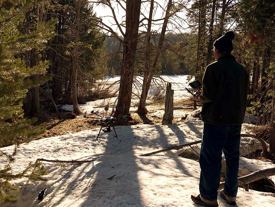
As part of the College’s Experiment Station unit, and in partnership with the Desert Research Institute in Las Vegas, Harpold and his team are conducting a field study on the impact of wildfire on the Illilouette Creek watershed in the Yosemite wilderness area in California. They’re looking at how much water makes it to streams for people and downstream agriculture after a fire, and how much water stays in the post-fire landscape to both make vegetation grow and make vegetation resilient to other disturbances, such as drought.
“We derive our water supply from these forests that burn,” Harpold said. “So, we need to think about how the forest burning or not burning affects how much water is available for people. We expect forest fires in mountain headwaters to increase pressure on our water supplies in the future.”
Students make observations to estimate water use at Sagehen Creek experimental forest.
How does less snow and more rain affect water movement and storage?
The second project, funded at $6.9 million and led by the University of Colorado at Boulder, looks at how climate change is impacting the availability and movement of water stored underground. Specifically, they’re investigating how the water movement and storage of five watersheds in Colorado and California impact how trees grow and how rocks weather and become soil. The goal of this project is to better understand how earth will respond to future climate changes, and how people can prepare for those responses.
For his part of the project, Harpold is leading research efforts at University of California, Berkley’s Sagehen Field Creek Field Station near Truckee, California. Previous snowpack research performed by Harpold and others indicates that due to rising temperatures, the Sierra Nevada Mountains are seeing less snowfall and more rain. With more unfrozen water, Harpold and his team want to know how the water will be stored. For example, it could be stored underground, where it will likely be used by the vegetation and may not reach the reservoir. Or, it could move into the streams and reach the reservoir, which could affect how these reservoirs are managed for floods.
Harpold says the Sagehen Field Creek station stores a lot of groundwater and releases cold water all year long, making it an ideal location for practical applications for the results, such as native fisheries.
“The idea is that we get to collaborate with these folks from around the country at a field station in our backyard,” Harpold said. “There are people doing soil work, tree root work, geophysics and other research using tools to look at what’s underground in the critical zone.”
Harpold said there can be multiple impacts from snow shifting to rain, and then what happens to the water in the critical zone.
“For example, if snow shifts to rain in the Truckee Basin, then there is risk that there will not be enough cold water in the summer for native fish, such as Lahontan Trout,” he said. “This will be strongly mediated by the critical zone, which controls how much water is stored underground and how that water is released to streams and forests. For example, better understanding of the critical zone could then allow fish biologists to take targeted management actions to mitigate potential detrimental effects on important populations.”
Harpold says that over the next five years he hopes to connect more students to critical zone science through field experience, teaching, and outreach to his sites in the Sierra Nevada.


